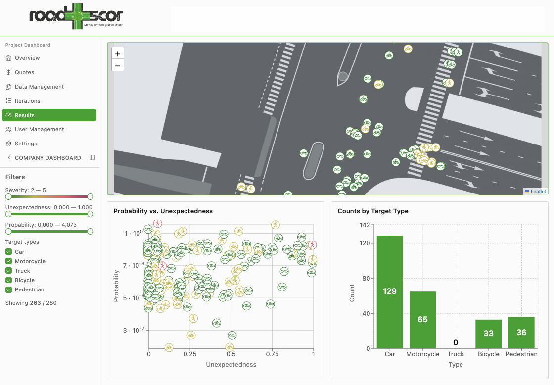
By simulating tens of thousands of scenarios, Roadscor identified over 600 critical conflicts, providing the City of Verona with a precise, evidence-based map of risk:
 VRU Hotspot Identification: High-risk zones were concentrated at wide surface crossings, where extended exposure times and complex vehicle trajectories amplified danger for pedestrians and cyclists.
 Behavioral Diagnostics: The analysis clarified why road users face elevated risk, linking unsafe behavior directly to specific design limitations.
 Targeted Safety Interventions: These findings provide a defensible foundation for future redevelopment, allowing planners to prioritize geometry improvements and enhanced pedestrian protection where they are needed most.
By replacing guesswork with drone-calibrated data, Roadscor ensures that future investments at Porta Vescovo are grounded in the reality of human behavior. This proactive approach allows the city to justify redevelopment costs and design for safety before physical implementation begins.