The analysis provided the technical justification needed to reconsider a redesign that had previously been discarded due to traffic-flow concerns. Roadscor’s results demonstrated:
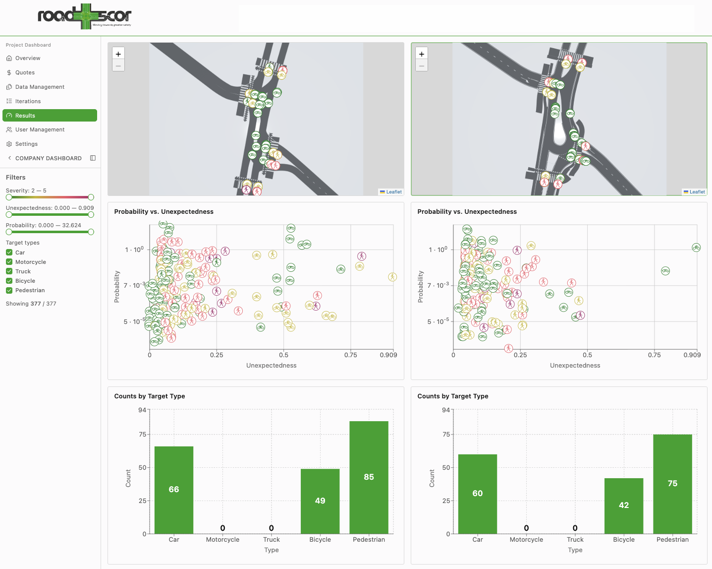
 Measurable Safety Gains: We proved the redesign’s ability to significantly reduce high-severity conflicts, providing a safety-first counter-argument to traditional flow-only metrics.
 Targeted Interventions: The hotspot map allowed planners to focus improvements precisely where pedestrians and cyclists were most at risk.
 Methodological Refinement: Conducted as part of an EIT Urban Mobility project, this study enabled Roadscor to refine its handling of unregulated yield negotiations, ensuring the technology delivers high accuracy in complex, unsignalized environments.
Roadscor transformed the decision-making process from a debate over traffic flow into a transparent evaluation of human safety. By quantifying the “invisible” risks of future growth, the city can now justify infrastructure investments that prioritize the protection of its most vulnerable citizens.